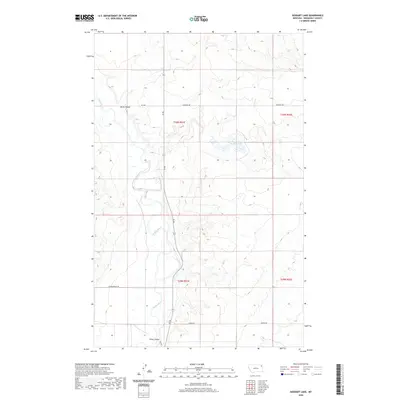
2020 Map of Geddart Lake
USGS Topo · Published 2020About this map
Poplar River meanders through this portion of Roosevelt County, carving a distinct path through the dry Montana landscape. The water systems of this quadrangle are vital markers for local history, including the namesake Geddart Lake and the drainage patterns defined by Kirns Coulee and Slims Coulee. These features represent the essential hydrology of the northern plains where water sources often dictated land use and settlement patterns.
Find a feature on this map
13 named features on this map. Tap any name to fly to it.
Don’t see what you’re looking for? This feature index may not catch every label — zoom into the map to look around manually.
Map Details
Editions of this 2020 Geddart Lake Map
This is the sole edition of this map. No revisions or reprints were ever made.
Other maps of this area

1909 · Smoke Creek
USGS Topo · 1:62,500

1912 · Hay Creek
USGS Topo · 1:62,500

1912 · Poplar
USGS Topo · 1:62,500

1912 · Smoke Creek
USGS Topo · 1:62,500

1914 · Brockton
USGS Topo · 1:62,500

1954 · Wolf Point
USGS Topo · 1:250,000

1958 · Wolf Point
USGS Topo · 1:250,000

1972 · Poplar NE
USGS Topo · 1:24,000
1972 · Badger Creek
USGS Topo · 1:24,000
1972 · Brockton
USGS Topo · 1:24,000