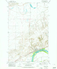
1972 Map of Brockton
USGS Topo · Published 1975About this map
Brockton stands as the primary hub of activity along the northern bank of the Missouri River in the early 1970s. This survey illustrates the town's role as a transportation and agricultural center, anchored by the Burlington Northern railroad line and a concentration of infrastructure including Storage Bins, an Athletic Field, and a local Rodeo Ground. The landscape is defined by the Port Peck Indian Reservation Boundary, which follows the river's path through this section of the plains.
Find a feature on this map
17 named features on this map. Tap any name to fly to it.
Don’t see what you’re looking for? This feature index may not catch every label — zoom into the map to look around manually.
Map Details
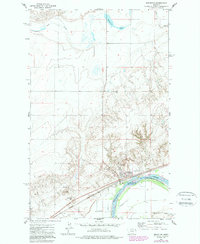
Editions of this 1972 Brockton Map
2 editions found
Other maps of this area

1909 · Smoke Creek
USGS Topo · 1:62,500

1912 · Hay Creek
USGS Topo · 1:62,500

1912 · Poplar
USGS Topo · 1:62,500

1912 · Smoke Creek
USGS Topo · 1:62,500

1914 · Brockton
USGS Topo · 1:62,500

1950 · Coyote Coulee
USGS Topo · 1:24,000

1950 · Calais
USGS Topo · 1:24,000

1954 · Wolf Point
USGS Topo · 1:250,000

1958 · Wolf Point
USGS Topo · 1:250,000

1972 · Poplar NE
USGS Topo · 1:24,000
Featured Places
- Brockton, Brockton District
- Brockton District, MT
- Richland County, MT
- Roosevelt County, MT
- United States