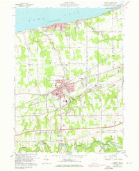
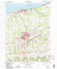
1960 Map of Geneva
USGS Topo · Published 1970About this map
The shore of Lake Erie defines the northern edge of this Ohio landscape, where the resort atmosphere of Geneva-on-the-Lake contrasts with the industrial and agricultural interior. The city of Geneva serves as a central hub, bifurcated by the competing tracks of the Penn Central and Norfolk and Western railroads. These transit lines supported a landscape of nurseries and small farms that stretched between the lake and the winding Grand River to the south.
Find a feature on this map
43 named features on this map. Tap any name to fly to it.
Don’t see what you’re looking for? This feature index may not catch every label — zoom into the map to look around manually.
Map Details
Editions of this 1960 Geneva Map
5 editions found
Other maps of this area

1904 · Chardon
USGS Topo · 1:62,500

1905 · Ashtabula
USGS Topo · 1:62,500

1905 · Perry
USGS Topo · 1:62,500

1905 · Jefferson
USGS Topo · 1:62,500

1906 · Chardon
USGS Topo · 1:62,500

1907 · Jefferson
USGS Topo · 1:62,500

1950 · Cleveland
USGS Topo · 1:250,000

1956 · Cleveland
USGS Topo · 1:250,000

1959 · East Trumbull
USGS Topo · 1:24,000

1960 · Ashtabula South
USGS Topo · 1:24,000