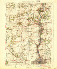
1932 Map of Geneva
USGS Topo · Published 1932About this map
The Fox River valley serves as the central artery for this 1932 Illinois landscape, connecting the industrial and residential hubs of St Charles, Geneva, Batavia, and Aurora. At this time, the river corridor was a dense network of transit and social institutions, featuring the State School for Boys and the State School for Girls, alongside the extensive grounds of Mooseheart. The map captures the region's complex rail infrastructure, with lines like the Chicago Aurora and Elgin and the Chicago Burlington & Quincy facilitating movement between these riverside cities and the surrounding rural townships.
Find a feature on this map
91 named features on this map. Tap any name to fly to it.
Don’t see what you’re looking for? This feature index may not catch every label — zoom into the map to look around manually.
Map Details
Editions of this 1932 Geneva Map
3 editions found
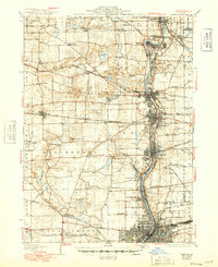
Other maps of this area

1892 · Joliet
USGS Topo · 1:62,500

1908 · Wheaton
USGS Topo · 1:62,500

1923 · Barrington
USGS Topo · 1:62,500

1923 · Joliet
USGS Topo · 1:62,500

1925 · Yorkville
USGS Topo · 1:62,500

1925 · Elgin
USGS Topo · 1:62,500

1932 · Geneva
USGS Topo · 1:62,500

1935 · Barrington
USGS Topo · 1:62,500

1937 · Sycamore
USGS Topo · 1:62,500

1938 · Genoa
USGS Topo · 1:62,500