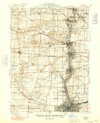
1932 Map of Geneva
USGS Topo · Published 1949About this map
The Fox River corridor anchors this portrait of industrial and institutional life in Kane County during the mid-twentieth century. Dense urban development clusters along the riverbanks through St Charles, Geneva, and Batavia, while the surrounding prairie remains dominated by a systematic grid of country schools and named mounds. The map documents significant public institutions of the era, including the State School for Boys near Wasco and the State School for Girls in Geneva. A complex network of railroads, such as the Chicago and Northwestern Ry and the Chicago Aurora and Elgin RR, intersects the landscape, connecting small farming junctions like La Fox and Elburn to the burgeoning industrial hub of Aurora. Landforms like Johnsons Mound and Bald Mound stand out against the flat agricultural reaches of Blackberry and Campton townships.
Find a feature on this map
86 named features on this map. Tap any name to fly to it.
Don’t see what you’re looking for? This feature index may not catch every label — zoom into the map to look around manually.
Map Details
Editions of this 1932 Geneva Map
3 editions found
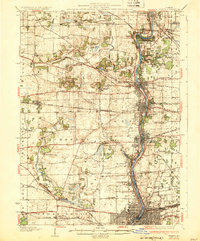
Other maps of this area

1892 · Joliet
USGS Topo · 1:62,500

1908 · Wheaton
USGS Topo · 1:62,500

1923 · Barrington
USGS Topo · 1:62,500

1923 · Joliet
USGS Topo · 1:62,500

1925 · Yorkville
USGS Topo · 1:62,500

1925 · Elgin
USGS Topo · 1:62,500

1932 · Geneva
USGS Topo · 1:62,500

1935 · Barrington
USGS Topo · 1:62,500

1937 · Sycamore
USGS Topo · 1:62,500

1938 · Genoa
USGS Topo · 1:62,500