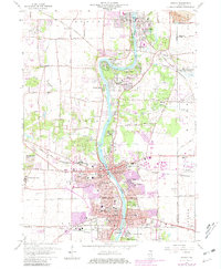
1964 Map of Geneva
USGS Topo · Published 1981About this map
The Fox River carves a central path through this survey, anchoring the development of St Charles and Geneva as they appeared before the peak of suburban expansion. The riverbank is densely populated with community landmarks, from religious institutions like Sacred Heart Seminary and Mount St Mary Academy to recreational spaces like Five Islands Park. The 1980 photorevisions, marked in purple, highlight significant growth in residential areas such as Fox River Estates and Rainbow Hills. This document captures the transition of the Fox Valley from a series of distinct river towns into a more continuous corridor of industry and housing, while still preserving large green belts like Pratts Wayne Woods Forest Preserve. Transportation remains tied to the Chicago and North Western rail lines that once fueled the growth of the grain and gravel industries.
Find a feature on this map
72 named features on this map. Tap any name to fly to it.
Don’t see what you’re looking for? This feature index may not catch every label — zoom into the map to look around manually.
Map Details
Editions of this 1964 Geneva Map
4 editions found
Other maps of this area

1908 · Wheaton
USGS Topo · 1:62,500

1923 · Barrington
USGS Topo · 1:62,500

1925 · Elgin
USGS Topo · 1:62,500

1932 · Geneva
USGS Topo · 1:62,500

1935 · Barrington
USGS Topo · 1:62,500

1940 · Elgin
USGS Topo · 1:62,500

1948 · Wheaton
USGS Topo · 1:62,500

1948 · Geneva
USGS Topo · 1:62,500

1949 · Geneva
USGS Topo · 1:24,000

1950 · Aurora North
USGS Topo · 1:24,000