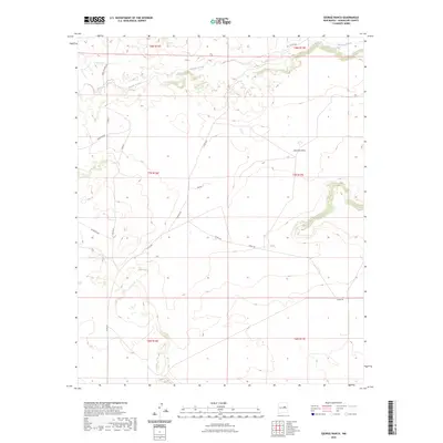
2023 Map of George Ranch
USGS Topo · Published 2023About this map
Pintada Arroyo winds through the northern reaches of this Guadalupe County landscape, defining the local drainage patterns alongside Leoncito Draw. The area is characterized by a network of ranching roads and township boundaries, including the intersection of t8n r16e and t7n r17e. This 2023 survey illustrates the modern configuration of rural access routes such as Highland Rd and Muniz Rd, which serve the expansive terrain of the Mesa De Leon Rd corridor. The map provides a contemporary look at land divisions and essential watercourses in a part of New Mexico defined by its open range and sparsely distributed infrastructure, documenting the persistent paths of historical routes like Pintada Rd and Co Rd 4ea across the high plains.
Find a feature on this map
18 named features on this map. Tap any name to fly to it.
Don’t see what you’re looking for? This feature index may not catch every label — zoom into the map to look around manually.
Map Details
Editions of this 2023 George Ranch Map
This is the sole edition of this map. No revisions or reprints were ever made.
Other maps of this area

1954 · Fort Sumner
USGS Topo · 1:250,000

1958 · Fort Sumner
USGS Topo · 1:250,000
1978 · Milagro Spring
USGS Topo · 1:24,000
1978 · George Ranch
USGS Topo · 1:24,000

1978 · Mesa Leon
USGS Topo · 1:24,000
1978 · Tapia Ranch
USGS Topo · 1:24,000
1978 · Pintada
USGS Topo · 1:24,000

1978 · Santa Barbara Lake
USGS Topo · 1:24,000
1978 · Milagro
USGS Topo · 1:24,000
1978 · Pinavete Canyon
USGS Topo · 1:24,000