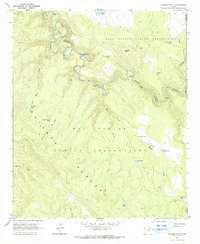
1966 Map of Georges Butte
USGS Topo · Published 1967About this map
The Black River carves a winding path through the center of this landscape, acting as a natural divider between the Fort Apache Indian Reservation and the San Carlos Indian Reservation. The terrain is defined by the high, broad expanse of the Natanes Plateau and sharp descents into watercourses like Deer Creek and Kidde Canyon. Navigation through this isolated country is primarily restricted to a single Jeep Trail, illustrating the rugged, undeveloped nature of the reservation interior in the mid-1960s.
Find a feature on this map
28 named features on this map. Tap any name to fly to it.
Don’t see what you’re looking for? This feature index may not catch every label — zoom into the map to look around manually.
Map Details
Editions of this 1966 Georges Butte Map
2 editions found

Other maps of this area

1954 · Clifton
USGS Topo · 1:250,000

1954 · Mesa
USGS Topo · 1:250,000

1957 · Mesa
USGS Topo · 1:250,000

1957 · Clifton
USGS Topo · 1:250,000

1958 · Clifton
USGS Topo · 1:250,000

1958 · Mesa
USGS Topo · 1:250,000

1960 · Mesa
USGS Topo · 1:250,000

1962 · Clifton
USGS Topo · 1:250,000

1964 · Mesa
USGS Topo · 1:250,000
1966 · Bronco Gulch
USGS Topo · 1:24,000