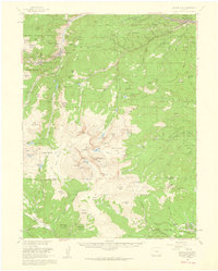
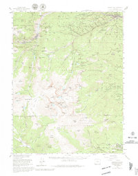
1957 Map of Georgetown
USGS Topo · Published 1960About this map
Georgetown and Silver Plume sit at the northern heart of this survey, surrounded by the intense mining legacy of the Front Range. The landscape is a network of mid-century industrial activity, including the Lamartine Mine, Black Eagle Mine, and numerous portals like the Sunburst Tunnels and Queen City Tunnel. In the high peaks, the Inter Univ High Altitude Lab near Mt Evans and Summit Lake signifies the area's shift toward scientific research and alpine recreation.
Find a feature on this map
129 named features on this map. Tap any name to fly to it.
Don’t see what you’re looking for? This feature index may not catch every label — zoom into the map to look around manually.
Map Details
Editions of this 1957 Georgetown Map
5 editions found
Other maps of this area

1893 · Platte Canyon
USGS Topo · 1:125,000

1899 · West Denver
USGS Topo · 1:125,000

1903 · Georgetown
USGS Topo · 1:62,500

1905 · Central City
USGS Topo · 1:62,500

1905 · Georgetown
USGS Topo · 1:62,500

1906 · Blackhawk
USGS Topo · 1:62,500

1910 · Central City
USGS Topo · 1:62,500

1912 · Central City
USGS Topo · 1:62,500

1924 · Montezuma
USGS Topo · 1:62,500

1924 · Fraser
USGS Topo · 1:62,500