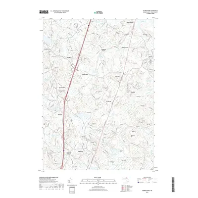
2018 Map of Georgetown
USGS Topo · Published 2018About this map
Topsfield and Georgetown anchor this inland portion of Essex County, where the landscape is defined by the winding course of the Ipswich River and its numerous tributaries. The terrain is characterized by a series of drumlins and rises, including Turner Hill, Bartholomew Hill, and Prospect Hill, which overlook a network of wetlands and ponds such as Hood Pond and Wilson Pond. The settlement pattern follows older crossroads like Kinsman Corner and Doles Corner, while modern corridors like the Newburyport Tpke cut through the traditional geography of Rooty Plain and Marlboro. Local history is preserved in numerous legacy sites, from the Rowley Burial Ground to the extensive grounds of Bradley Palmer State Park. The distribution of cemeteries, including Harmony Cem and Village Cem, provides a detailed record of the various village centers that have long characterized this part of the Massachusetts North Shore.
Find a feature on this map
78 named features on this map. Tap any name to fly to it.
Don’t see what you’re looking for? This feature index may not catch every label — zoom into the map to look around manually.
Map Details
Editions of this 2018 Georgetown Map
This is the sole edition of this map. No revisions or reprints were ever made.
Other maps of this area

1886 · Lawrence
USGS Topo · 1:62,500

1888 · Newburyport
USGS Topo · 1:62,500

1888 · Haverhill
USGS Topo · 1:62,500

1888 · Lawrence
USGS Topo · 1:62,500

1888 · Salem
USGS Topo · 1:62,500

1890 · Haverhill
USGS Topo · 1:62,500

1890 · Newburyport
USGS Topo · 1:62,500

1893 · Salem
USGS Topo · 1:62,500

1893 · Lawrence
USGS Topo · 1:62,500

1893 · Haverhill
USGS Topo · 1:62,500