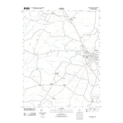
2011 Map of Georgetown
USGS Topo · Published 2011About this map
Georgetown serves as the focal point of this Delaware landscape, featuring a dense network of residential developments such as Highland Terrace, Harlemtown, and Swain Acres. The town's infrastructure is clearly defined, from the Georgetown Post Office to the Georgetown Wastewater Reclamation Facility. Surrounding the town, a complex system of drainage ditches and branches, including the Layton-Vaughn Ditch and Mifflin Ditch, illustrates the agricultural management of the Sussex County terrain.
Find a feature on this map
95 named features on this map. Tap any name to fly to it.
Don’t see what you’re looking for? This feature index may not catch every label — zoom into the map to look around manually.
Map Details
Editions of this 2011 Georgetown Map
This is the sole edition of this map. No revisions or reprints were ever made.
Other maps of this area

1915 · Seaford
USGS Topo · 1:62,500

1917 · Millsboro
USGS Topo · 1:62,500

1918 · Cedar Creek
USGS Topo · 1:62,500

1918 · Harrington
USGS Topo · 1:62,500

1919 · Cedar Creek
USGS Topo · 1:62,500

1938 · Cedar Creek
USGS Topo · 1:62,500

1938 · Millsboro
USGS Topo · 1:62,500
1944 · Milton
USGS Topo · 1:24,000

1944 · Cedar Creek
USGS Topo · 1:62,500

1944 · Millsboro
USGS Topo · 1:62,500