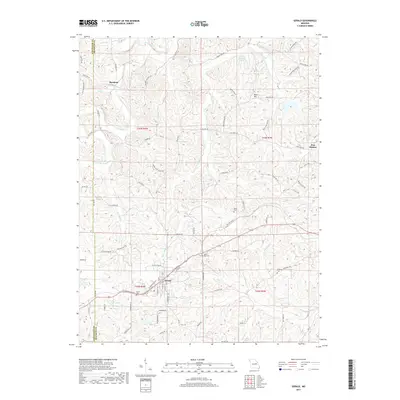
2017 Map of Gerald
USGS Topo · Published 2017About this map
Gerald sits at the junction of modern transportation routes and early settlement patterns, serving as a focal point for the surrounding rural landscape in Franklin County. The topography is defined by the branching drainages of Boeuf Cr and Cedar Fork, which carve through the terrain and influence the winding paths of roads like Koppelmann Valley Rd and Buffalo Ridge Rd. To the north, the small community of Beemont and the high point at Bald Hill overlook a network of creeks, including Saint Johns Cr and Opossum Cr. The map preserves the locations of several burial grounds, such as Boeuf Cem and Saint Paul Cem, which offer significant value for genealogical research. Further east, Port Hudson marks another historic node in this agricultural region, while Harry Panhorst Lake provides a notable water feature amidst the rolling hills of the Gasconade and Franklin County borderlands.
Find a feature on this map
77 named features on this map. Tap any name to fly to it.
Don’t see what you’re looking for? This feature index may not catch every label — zoom into the map to look around manually.
Map Details
Editions of this 2017 Gerald Map
This is the sole edition of this map. No revisions or reprints were ever made.
Other maps of this area

1890 · Hermann
USGS Topo · 1:125,000

1903 · Sullivan
USGS Topo · 1:125,000

1935 · Gerald
USGS Topo · 1:48,000

1936 · Hermann
USGS Topo · 1:48,000

1941 · Gerald
USGS Topo · 1:62,500

1942 · Hermann
USGS Topo · 1:62,500

1944 · Gerald
USGS Topo · 1:62,500

1945 · Hermann
USGS Topo · 1:62,500

1946 · Union
USGS Topo · 1:62,500

1948 · Union
USGS Topo · 1:62,500