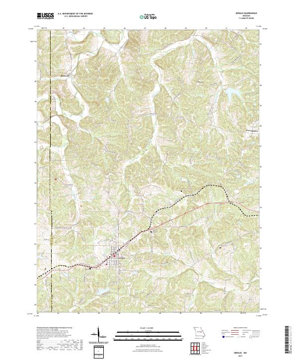
2021 Map of Gerald
USGS Topo · Published 2021About this map
Gerald sits at the intersection of modern transit and agricultural history along the western edge of Franklin County. This interior landscape is defined by the headwaters of several significant drainages, including Boeuf Cr and Cedar Fork, which carve through the terrain south of the Gasconade County line. The settlement pattern remains largely rural, anchored by small communities like Beemont and Port Hudson that serve as local hubs for the surrounding farmsteads.
Find a feature on this map
78 named features on this map. Tap any name to fly to it.
Don’t see what you’re looking for? This feature index may not catch every label — zoom into the map to look around manually.
Map Details
Editions of this 2021 Gerald Map
This is the sole edition of this map. No revisions or reprints were ever made.
Other maps of this area

1890 · Hermann
USGS Topo · 1:125,000

1903 · Sullivan
USGS Topo · 1:125,000

1935 · Gerald
USGS Topo · 1:48,000

1936 · Hermann
USGS Topo · 1:48,000

1941 · Gerald
USGS Topo · 1:62,500

1942 · Hermann
USGS Topo · 1:62,500

1944 · Gerald
USGS Topo · 1:62,500

1945 · Hermann
USGS Topo · 1:62,500

1946 · Union
USGS Topo · 1:62,500

1948 · Union
USGS Topo · 1:62,500