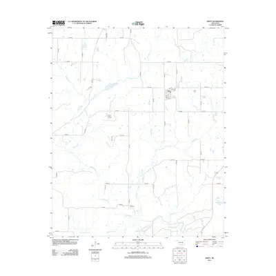
2012 Map of Gerty
USGS Topo · Published 2012About this map
Gerty forms the primary settlement on this sheet, organized along a small grid of streets including 2nd St through 8th St. The town's historical geography is anchored by the Gerty Cem to the east and the Panther Creek Cem to the south, providing clear points of interest for genealogists tracing Hughes County roots. The surrounding landscape is defined by a dense network of waterways, most notably Muddy Boggy Cr along the southern edge and several branches like Big Sandy Cr and Panther Cr that carve through the section lines.
Find a feature on this map
47 named features on this map. Tap any name to fly to it.
Don’t see what you’re looking for? This feature index may not catch every label — zoom into the map to look around manually.
Map Details
Editions of this 2012 Gerty Map
This is the sole edition of this map. No revisions or reprints were ever made.
Other maps of this area

1896 · Coalgate
USGS Topo · 1:125,000

1899 · Coalgate
USGS Topo · 1:125,000

1900 · Coalgate
USGS Topo · 1:125,000

1957 · Tupelo NE
USGS Topo · 1:24,000

1957 · Ardmore
USGS Topo · 1:250,000

1958 · Lula
USGS Topo · 1:24,000

1958 · Steedman
USGS Topo · 1:24,000

1963 · Ardmore
USGS Topo · 1:250,000

1967 · Calvin East
USGS Topo · 1:24,000
1967 · Non
USGS Topo · 1:24,000