
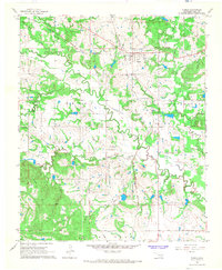
1957 Map of Tupelo NE
USGS Topo · Published 1959About this map
Muddy Boggy Creek and its complex network of tributaries, including Cedar Creek, Rock Creek, and Black Creek, dominate this rural Oklahoma landscape. The 1957 survey captures a period of active land use in Coal County, with the Diamond Bar Ranch and the small settlement at Sutter serving as primary local landmarks. The terrain is dotted with markers of community life and industry, such as Boiling Springs Ch, Glass Cem, and evidence of resource extraction including a Gravel Pit and an Oil Well. This survey was produced through a collaboration between the Geological Survey and the City of Oklahoma City Department of Public Works, reflecting the importance of water management and rural infrastructure in the mid-century. The map meticulously records the intersection of Jackson, Jefferson, and Haskell townships, providing a clear view of the area's social and natural geography before significant modern development.
Find a feature on this map
16 named features on this map. Tap any name to fly to it.
Don’t see what you’re looking for? This feature index may not catch every label — zoom into the map to look around manually.
Map Details
Editions of this 1957 Tupelo NE Map
This is the sole edition of this map. No revisions or reprints were ever made.
Other maps of this area

1896 · Coalgate
USGS Topo · 1:125,000

1899 · Coalgate
USGS Topo · 1:125,000

1900 · Coalgate
USGS Topo · 1:125,000

1957 · Coalgate
USGS Topo · 1:24,000

1957 · Centrahoma
USGS Topo · 1:24,000

1957 · Ardmore
USGS Topo · 1:250,000

1958 · Lula
USGS Topo · 1:24,000

1958 · Steedman
USGS Topo · 1:24,000

1963 · Ardmore
USGS Topo · 1:250,000
1966 · Tupelo
USGS Topo · 1:24,000