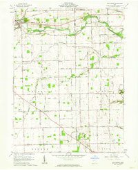
1961 Map of Gettysburg
USGS Topo · Published 1962About this map
Greenville Creek meanders through the northern section of this territory, where the village of Gettysburg serves as a primary hub during the early 1960s. The landscape is defined by a dense network of rural roads such as Gettysburg Road and Hogpath Road, connecting small farming communities and religious centers. Scattered throughout the townships of Adams, Newberry, and Franklin are several country churches including Greenville Creek Ch, Painter Creek Ch, and the German Ch.
Find a feature on this map
90 named features on this map. Tap any name to fly to it.
Don’t see what you’re looking for? This feature index may not catch every label — zoom into the map to look around manually.
Map Details
Editions of this 1961 Gettysburg Map
2 editions found
Other maps of this area

1905 · Brookville
USGS Topo · 1:62,500

1911 · Covington
USGS Topo · 1:62,500

1944 · Covington
USGS Topo · 1:62,500

1953 · Cincinnati
USGS Topo · 1:250,000

1953 · Muncie
USGS Topo · 1:250,000

1955 · West Milton
USGS Topo · 1:24,000

1956 · Muncie
USGS Topo · 1:250,000

1957 · Cincinnati
USGS Topo · 1:250,000

1961 · Laura
USGS Topo · 1:24,000

1961 · Dawn
USGS Topo · 1:24,000