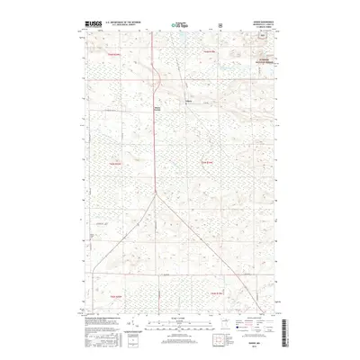
2016 Map of Gheen
USGS Topo · Published 2016About this map
Gheen and Gheen Corner sit at the center of this 2016 survey, representing a concentrated pocket of settlement in the wooded landscape of northern Minnesota. The area is defined by its complex hydrography, where the Willow River and Elbow River wind through the terrain, the latter punctuated by the Elbow Rapids. Much of the northeastern quadrant is protected as part of the Superior National Forest, while the southwestern section features the Willow Valley Cem near the intersection of Chisholm Rd and Leathers Rd. The map illustrates a network of rural routes including St Louis Co Hwy 74 and Carpenter Rd, which connect remote homesteads and logging areas. This data reflects the modern state of Saint Louis County's managed forests and scattered residential clearings, showing how the local road system navigates around significant wetlands and water bodies like Rice Lake.
Find a feature on this map
28 named features on this map. Tap any name to fly to it.
Don’t see what you’re looking for? This feature index may not catch every label — zoom into the map to look around manually.
Map Details
Editions of this 2016 Gheen Map
This is the sole edition of this map. No revisions or reprints were ever made.
Other maps of this area

1954 · Hibbing
USGS Topo · 1:250,000

1954 · International Falls
USGS Topo · 1:250,000

1957 · Hibbing
USGS Topo · 1:250,000

1957 · International Falls
USGS Topo · 1:250,000

1958 · International Falls
USGS Topo · 1:250,000

1958 · Hibbing
USGS Topo · 1:250,000

1964 · Hibbing
USGS Topo · 1:250,000

1964 · Linden Grove
USGS Topo · 1:24,000

1964 · Haley
USGS Topo · 1:24,000

1964 · Gheen NW
USGS Topo · 1:24,000