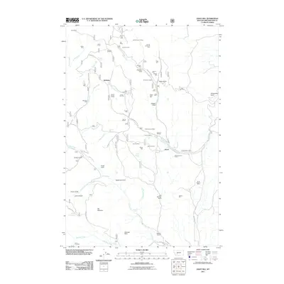
2011 Map of Giant Hill
USGS Topo · Published 2011About this map
Giant Hill rises over a landscape defined by an intensive legacy of mining in the Elkhorn Mountains region. This 2011 survey reveals an intricate network of early claims and workings, such as the Vulture Mine, Saint Louis Mine, and the Bullion King Mine, scattered across the drainages of Indian Creek and Crow Creek. The small settlement sites of McMullan and Hassel represent the human footprint in this mineral-rich terrain, connected by rugged routes like Silver Wave Rd and Indian Creek Rd.
Find a feature on this map
74 named features on this map. Tap any name to fly to it.
Don’t see what you’re looking for? This feature index may not catch every label — zoom into the map to look around manually.
Map Details
Editions of this 2011 Giant Hill Map
This is the sole edition of this map. No revisions or reprints were ever made.
Other maps of this area

1886 · Fort Logan
USGS Topo · 1:250,000

1948 · White Sulphur Springs
USGS Topo · 1:250,000

1949 · Radersburg
USGS Topo · 1:62,500

1950 · Devils Fence
USGS Topo · 1:62,500

1950 · Townsend
USGS Topo · 1:62,500

1950 · Clancy
USGS Topo · 1:62,500

1958 · White Sulphur Springs
USGS Topo · 1:250,000

1961 · White Sulphur Springs
USGS Topo · 1:250,000

1965 · White Sulphur Springs
USGS Topo · 1:250,000

1976 · Townsend
USGS Topo · 1:100,000