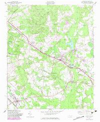
1949 Map of Gibson
USGS Topo · Published 1983About this map
Gibson anchors the southwestern corner of this survey, a rail town situated at the junction of the Seaboard Coast Line just above the border between North Carolina and South Carolina. The map captures a landscape defined by milling operations and rural family settlements, with the Richmond Mill and Ida Mill utilizing the waters of Gum Swamp Creek. These industrial points are surrounded by numerous community hubs, including the Old Hundred Sch and the Baysville Sch, which served the local farming population.
Find a feature on this map
66 named features on this map. Tap any name to fly to it.
Don’t see what you’re looking for? This feature index may not catch every label — zoom into the map to look around manually.
Map Details
Editions of this 1949 Gibson Map
3 editions found
Other maps of this area

1942 · Rockingham
USGS Topo · 1:125,000

1949 · Gibson
USGS Topo · 1:24,000

1949 · Ghio
USGS Topo · 1:24,000

1949 · Laurinburg
USGS Topo · 1:24,000

1949 · Silver Hill
USGS Topo · 1:24,000

1949 · Marston
USGS Topo · 1:24,000

1949 · Hamlet
USGS Topo · 1:24,000

1949 · Hamlet
USGS Topo · 1:62,500

1949 · Laurinburg
USGS Topo · 1:62,500

1953 · Florence
USGS Topo · 1:250,000