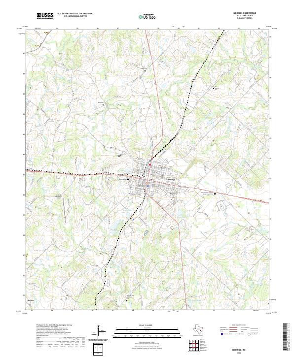
2022 Map of Giddings
USGS Topo · Published 2022About this map
Giddings serves as the central hub of this Lee County landscape, where the Lee County Courthouse and Lee County District Court Building anchor the downtown grid. The surrounding countryside is defined by a dense network of watercourses including Rabbs Creek, Bullfrog Cr, and Nails Cr, which feed local reservoirs like Walter Droemer Lake and Seales Lakes. This area is a significant corridor for family history and genealogy, preserving numerous rural burial sites such as the Betts Chapel Cem, the Keng Cem, and the Goucher Cem Historical Site located near Sandy Cr. To the southwest, the small settlement of Serbin marks the edge of the survey, while the Giddings Lee County Airport sits just west of the primary township. The map captures the modern infrastructure of central Texas, from county roads like Manheim Rd to the intersection of major transit lines that continue to shape the region’s growth.
Find a feature on this map
149 named features on this map. Tap any name to fly to it.
Don’t see what you’re looking for? This feature index may not catch every label — zoom into the map to look around manually.
Map Details
Editions of this 2022 Giddings Map
This is the sole edition of this map. No revisions or reprints were ever made.
Other maps of this area

1885 · Bastrop
USGS Topo · 1:125,000

1893 · Bastrop
USGS Topo · 1:125,000

1904 · Bastrop
USGS Topo · 1:125,000

1919 · Giddings
USGS Topo · 1:62,500

1919 · Dime Box
USGS Topo · 1:62,500

1948 · Smithville
USGS Topo · 1:62,500

1948 · Lexington
USGS Topo · 1:62,500

1950 · Lexington
USGS Topo · 1:62,500

1950 · Smithville
USGS Topo · 1:62,500

1954 · Austin
USGS Topo · 1:250,000