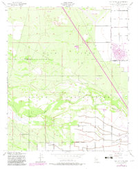
1952 Map of Gila Butte NW
USGS Topo · Published 1982About this map
The Gila River Indian Reservation dominates this 1950s landscape, centered on the ancient archeological site of Snaketown and the community of Bapchule. The Gila River meanders across the central portion of the sheet, bordered by an extensive Levee system designed to manage the floodplain. This survey captures a rural landscape in transition, where traditional irrigation and riverside settlements exist alongside modern infrastructure like Memorial Airfield and the burgeoning suburban layout of a circular Golf Course in the northeast corner.
Find a feature on this map
19 named features on this map. Tap any name to fly to it.
Don’t see what you’re looking for? This feature index may not catch every label — zoom into the map to look around manually.
Map Details
Editions of this 1952 Gila Butte NW Map
3 editions found

Other maps of this area

1912 · Phoenix
USGS Topo · 1:62,500

1913 · Mesa
USGS Topo · 1:62,500

1913 · Maricopa
USGS Topo · 1:62,500

1914 · Gila Butte
USGS Topo · 1:62,500

1914 · Phoenix
USGS Topo · 1:62,500

1915 · Mesa
USGS Topo · 1:62,500

1915 · Maricopa
USGS Topo · 1:62,500

1917 · Gila Butte
USGS Topo · 1:62,500

1952 · Gila Butte SE
USGS Topo · 1:24,000

1952 · Maricopa
USGS Topo · 1:24,000