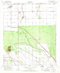
1952 Map of Gila Butte
USGS Topo · Published 1968About this map
Gila River Indian Reservation lands dominate the southern half of this mid-century landscape, where the Gila River meanders through Pinal County. The map documents an area defined by indigenous community centers and mission-led education, including the St Peters Mission Sch near the settlement of Bapchule and the Santan Day Sch further east. The transition from reservation territory to the developed agriculture of the north is marked by the Maricopa Co Pinal Co boundary and the vital waters of the Consolidated Canal.
Find a feature on this map
29 named features on this map. Tap any name to fly to it.
Don’t see what you’re looking for? This feature index may not catch every label — zoom into the map to look around manually.
Map Details
Editions of this 1952 Gila Butte Map
4 editions found

Other maps of this area

1904 · Desert Well
USGS Topo · 1:62,500

1906 · Desert Well
USGS Topo · 1:62,500

1907 · Sacaton
USGS Topo · 1:62,500

1913 · Mesa
USGS Topo · 1:62,500

1914 · Gila Butte
USGS Topo · 1:62,500

1915 · Mesa
USGS Topo · 1:62,500

1917 · Gila Butte
USGS Topo · 1:62,500

1952 · Gila Butte SE
USGS Topo · 1:24,000

1952 · Chandler
USGS Topo · 1:24,000

1952 · Sacaton Butte
USGS Topo · 1:24,000