
1906 Map of Gilbert Peak
USGS Topo · Published 1906About this map
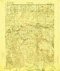
Gilbert Peak stands as a central landmark in this high-altitude survey of the Uinta Mountains during the early twentieth century. This was a period when the high Uintas were primarily defined by their inclusion in the Uinta Forest Reserve, a landscape dominated by the headwaters of major river systems like the Uinta River and Henrys Fork. The presence of Smiths Ranch and Edwards Ranch near the Wyoming Utah boundary line indicates the early pastoral economy that relied on these mountain drainages. The map reveals a complex glacial topography, naming remote features such as the Red Castle formation and the sheer heights of Kings Peaks. These early surveys recorded the vital water sources and summer grazing grounds of Gilbert Meadows and Beaver Meadows before modern development or intensive recreation altered the character of this high-wilderness region.
Find a feature on this map
43 named features on this map. Tap any name to fly to it.
Don’t see what you’re looking for? This feature index may not catch every label — zoom into the map to look around manually.
Map Details
Editions of this 1906 Gilbert Peak Map
4 editions found
Other maps of this area

1885 · Ashley
USGS Topo · 1:250,000

1885 · Uinta
USGS Topo · 1:250,000

1901 · Hayden Peak
USGS Topo · 1:125,000

1903 · Hayden Peak
USGS Topo · 1:125,000

1905 · Gilbert Peak
USGS Topo · 1:125,000

1906 · Marsh Peak
USGS Topo · 1:125,000

1908 · Marsh Peak
USGS Topo · 1:125,000

1917 · Vernal
USGS Topo · 1:125,000

1939 · Duchesne
USGS Topo · 1:125,000

1954 · Salt Lake City
USGS Topo · 1:250,000