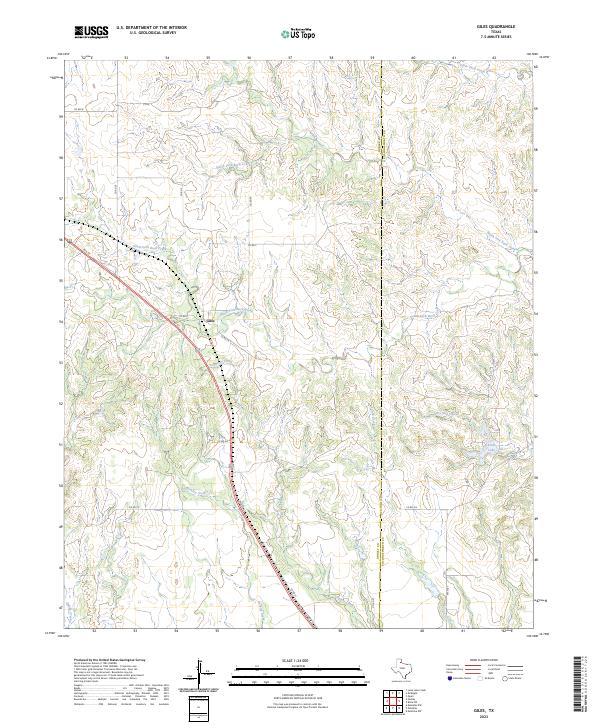
2023 Map of Giles
USGS Topo · Published 2023About this map
The small settlement of Giles sits at the heart of this Donley County landscape, positioned along a transportation corridor where the local road network converges. The terrain is defined by a dense network of seasonal watercourses and drainage basins, including the branching paths of South Fork Buck Creek and North Fork Buck Creek. To the east, the geography shifts slightly as the Donley and Collingsworth County line runs north-to-south, marking the jurisdictional boundary in an area otherwise dominated by open ranchland and creek valleys. Evidence of local recreation and water management is seen near the county line at Club Lake and the nearby Club Spring. The map details a web of rural routes like Co Rd Z and Co Rd 31, which connect isolated parcels of land to the primary throughway of 2nd St.
Find a feature on this map
28 named features on this map. Tap any name to fly to it.
Don’t see what you’re looking for? This feature index may not catch every label — zoom into the map to look around manually.
Map Details
Editions of this 2023 Giles Map
This is the sole edition of this map. No revisions or reprints were ever made.
Other maps of this area

1954 · Plainview
USGS Topo · 1:250,000

1958 · Plainview
USGS Topo · 1:250,000

1959 · Lelia Lake Creek
USGS Topo · 1:24,000

1959 · McKnight
USGS Topo · 1:24,000

1961 · Memphis
USGS Topo · 1:62,500

1961 · Estelline
USGS Topo · 1:62,500

1963 · Hedley
USGS Topo · 1:24,000

1963 · Giles
USGS Topo · 1:24,000

1964 · Rolla SW
USGS Topo · 1:24,000

1964 · Quail
USGS Topo · 1:24,000