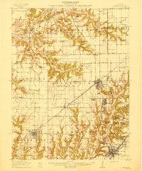
1915 Map of Gillespie
USGS Topo · Published 1915About this map
Gillespie and the surrounding coal-rich landscape of Macoupin County appear here during a peak era of industrial and rail expansion. The map reveals an intricate network of competing rail lines, including the Illinois Traction and the Chicago and St Louis, which served the region's productive coal fields. Heavy industry is marked by prominent facilities like the Coal Washer near Gillespie and numbered operations such as Mine No 1 and Mine No 3.
Find a feature on this map
73 named features on this map. Tap any name to fly to it.
Don’t see what you’re looking for? This feature index may not catch every label — zoom into the map to look around manually.
Map Details
Editions of this 1915 Gillespie Map
3 editions found
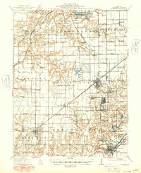
Other maps of this area

1912 · Gillespie
USGS Topo · 1:62,500

1915 · Gillespie
USGS Topo · 1:62,500

1915 · Mount Olive
USGS Topo · 1:62,500

1923 · Carlinville
USGS Topo · 1:48,000

1923 · Raymond
USGS Topo · 1:62,500

1925 · Carlinville
USGS Topo · 1:62,500

1925 · Raymond
USGS Topo · 1:62,500

1925 · Brighton
USGS Topo · 1:62,500

1927 · Alton
USGS Topo · 1:62,500

1927 · Edwardsville
USGS Topo · 1:62,500