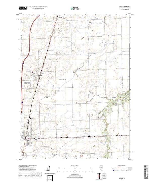
2024 Map of Gilman
USGS Topo · Published 2024About this map
Gilman and the nearby villages of Danforth and Ashkum anchor this modern-day layout of Iroquois County. The landscape is defined by the agricultural grid of the Illinois prairie, where a complex network of section-line roads like E 2500 N Rd and Co Rd 800 E intersects the natural drainage of Prairie Creek. The map provides specific locations for local family and community history, including Danforth Cem, Wenger Cem, and Bardon Cem, which are situated along the rural township routes.
Find a feature on this map
74 named features on this map. Tap any name to fly to it.
Don’t see what you’re looking for? This feature index may not catch every label — zoom into the map to look around manually.
Map Details
Editions of this 2024 Gilman Map
This is the sole edition of this map. No revisions or reprints were ever made.
Other maps of this area

1939 · Cissna Park
USGS Topo · 1:62,500

1944 · Piper City
USGS Topo · 1:48,000

1944 · Gilman
USGS Topo · 1:62,500

1946 · Gilman
USGS Topo · 1:62,500

1947 · Piper City
USGS Topo · 1:62,500

1948 · Buckley
USGS Topo · 1:62,500

1949 · Cissna Park
USGS Topo · 1:62,500

1949 · Buckley
USGS Topo · 1:62,500

1953 · Danville
USGS Topo · 1:250,000

1955 · Danville
USGS Topo · 1:250,000