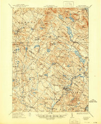
1927 Map of Gilmanton
USGS Topo · Published 1944About this map
Shaker Village and the industrial activity of Gilmanton Iron Works anchor this 1920s topography of central New Hampshire. The landscape is defined by its transition from high ridges like Loudon Ridge and Cogswell Mountain to the clustered settlements and water-powered mill sites that drove the local economy. At Carding Mill Pond, the map preserves the location of textile processing, while the Boston and Maine RR cuts through the southern reaches near Chichester Sta.
Find a feature on this map
140 named features on this map. Tap any name to fly to it.
Don’t see what you’re looking for? This feature index may not catch every label — zoom into the map to look around manually.
Map Details
Editions of this 1927 Gilmanton Map
5 editions found
Other maps of this area

1909 · Winnepesaukee
USGS Topo · 1:62,500

1917 · Mt. Pawtuckaway
USGS Topo · 1:62,500

1919 · Mt. Pawtuckaway
USGS Topo · 1:62,500

1919 · Gilmanton
USGS Topo · 1:62,500

1919 · Alton
USGS Topo · 1:62,500

1921 · Suncook
USGS Topo · 1:62,500

1925 · Holderness
USGS Topo · 1:62,500

1927 · Concord
USGS Topo · 1:62,500

1927 · Penacook
USGS Topo · 1:62,500

1927 · Gilmanton
USGS Topo · 1:62,500