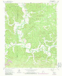
1964 Map of Gipsy
USGS Topo · Published 1985About this map
Gipsy and the surrounding woodlands of the Castor River State Forest define this 1964 survey, which reveals a landscape shaped by narrow hollows and the winding course of the Castor River. Small-scale farming and rural community life are evident in the scatter of landmark structures across the Wayne and Bollinger County line, including the Lower Turkey Creek Sch and multiple houses of worship like Cowan Ch and Pleasant Valley Ch. The mapping of features like Lime Kiln Hollow and Factory Pond provides specific clues to the local economy and land use of the mid-20th century. This edition includes purple revision overlays from 1982, showing updates to the road network and structures without changing the underlying topographic detail of the original field-checked survey. Family historians will find value in the precisely marked Maddox Cem, Scott Cem, and Clubb Cem.
Find a feature on this map
32 named features on this map. Tap any name to fly to it.
Don’t see what you’re looking for? This feature index may not catch every label — zoom into the map to look around manually.
Map Details
Editions of this 1964 Gipsy Map
This is the sole edition of this map. No revisions or reprints were ever made.
Other maps of this area

1930 · Coldwater
USGS Topo · 1:62,500

1933 · Marquand
USGS Topo · 1:62,500

1934 · Greenville
USGS Topo · 1:62,500

1935 · Zalma
USGS Topo · 1:62,500

1938 · Marquand
USGS Topo · 1:62,500

1939 · Greenville
USGS Topo · 1:62,500

1939 · Zalma
USGS Topo · 1:62,500

1949 · Rolla
USGS Topo · 1:250,000

1949 · Coldwater
USGS Topo · 1:62,500

1953 · Rolla
USGS Topo · 1:250,000