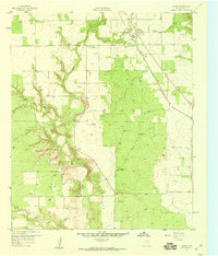
1959 Map of Girard
USGS Topo · Published 1960About this map
The town of Girard sits at the northern edge of the West Texas landscape, positioned where the Fort Worth and Denver (Burlington) railroad cuts across the plains. This late 1950s survey reveals a landscape shaped by both early industry and ranching infrastructure. Scattered throughout the brushy terrain are essential water sources named for local families, such as the North Whatley Windmill, South Whatley Windmill, and North Floyd Windmill.
Find a feature on this map
13 named features on this map. Tap any name to fly to it.
Don’t see what you’re looking for? This feature index may not catch every label — zoom into the map to look around manually.
Map Details
Editions of this 1959 Girard Map
2 editions found
Other maps of this area

1954 · Lubbock
USGS Topo · 1:250,000

1958 · Pursley House
USGS Topo · 1:24,000

1958 · Jayton
USGS Topo · 1:24,000

1959 · Gilpin
USGS Topo · 1:24,000

1959 · Girard
USGS Topo · 1:24,000

1967 · Spur
USGS Topo · 1:24,000

1968 · White Camp
USGS Topo · 1:24,000

1969 · Clairemont East
USGS Topo · 1:24,000

1969 · Clairemont West
USGS Topo · 1:24,000

1969 · Jayton South
USGS Topo · 1:24,000