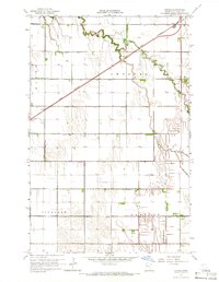
1964 Map of Girard
USGS Topo · Published 1966About this map
Burnham Creek meanders through this portion of Polk County, where the transition from natural waterways to an engineered agricultural landscape is nearly complete. By the mid-1960s, the prairie has been meticulously subdivided into townships like Andover, Roome, Vineland, and Hammond, each crisscrossed by an extensive network of drainage channels such as County Ditch No 63 and County Ditch No 112.
Find a feature on this map
29 named features on this map. Tap any name to fly to it.
Don’t see what you’re looking for? This feature index may not catch every label — zoom into the map to look around manually.
Map Details
Editions of this 1964 Girard Map
2 editions found
Other maps of this area

1919 · Eldred
USGS Topo · 1:62,500

1919 · Beltrami
USGS Topo · 1:62,500

1952 · Grand Forks
USGS Topo · 1:250,000

1953 · Crookston
USGS Topo · 1:62,500

1956 · Grand Forks
USGS Topo · 1:250,000

1964 · Beltrami
USGS Topo · 1:24,000

1964 · Beltrami SW
USGS Topo · 1:24,000

1964 · Girard
USGS Topo · 1:24,000

1964 · Greenview
USGS Topo · 1:24,000
1964 · Climax
USGS Topo · 1:24,000