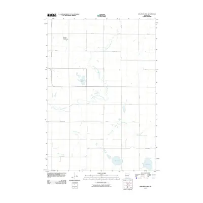
2010 Map of Gislason Lake
USGS Topo · Published 2010About this map
South Branch Yellow Medicine River meanders across this rural landscape, carving a serpentine path through the glacial till of Lyon County. This 2010 USGS survey documents a region defined by its water management and agricultural grid, anchored by features like the Hauschild-Thanghe Reservoir Dam in the northwest. The land is punctuated by numerous basins, including Gislason Lake, Goose Lake, and Island Lake, which serve as natural collection points for the drainage networks of Threemile Creek and Coon Creek. A precise network of section-line roads, including Lyon Lincoln Rd and County Hwy-13, organizes the territory, illustrating the persistent influence of the Public Land Survey System on the modern Minnesota prairie.
Find a feature on this map
22 named features on this map. Tap any name to fly to it.
Don’t see what you’re looking for? This feature index may not catch every label — zoom into the map to look around manually.
Map Details
Editions of this 2010 Gislason Lake Map
This is the sole edition of this map. No revisions or reprints were ever made.
Other maps of this area

1953 · Watertown
USGS Topo · 1:250,000

1953 · New Ulm
USGS Topo · 1:250,000

1957 · New Ulm
USGS Topo · 1:250,000

1958 · New Ulm
USGS Topo · 1:250,000

1958 · Watertown
USGS Topo · 1:250,000

1963 · Dead Coon Lake
USGS Topo · 1:24,000

1963 · Gislason Lake
USGS Topo · 1:24,000

1963 · Russell
USGS Topo · 1:24,000

1963 · Tyler
USGS Topo · 1:24,000

1963 · Lynd
USGS Topo · 1:24,000