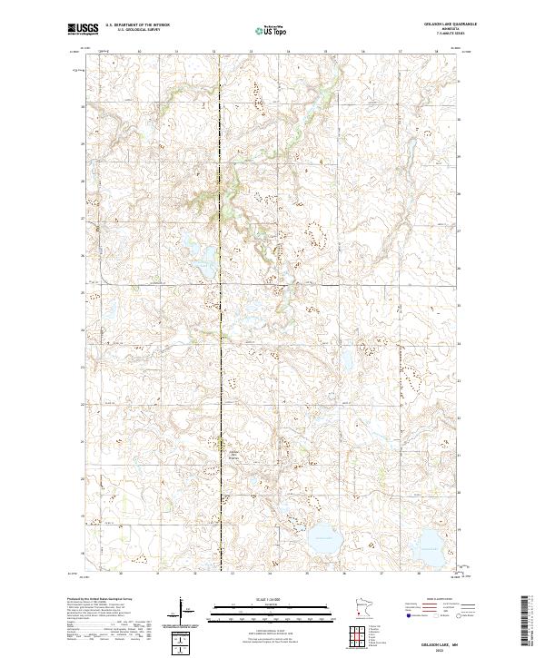
2022 Map of Gislason Lake
USGS Topo · Published 2022About this map
The Coteau des Prairies upland dominates the topography of this region along the border of Lyon and Lincoln counties. This prominent plateau rises above the surrounding plains, influencing the drainage of several small watercourses that navigate the glaciated terrain. The S Br Yellow Medicine River and Threemile Cr cut through the landscape, while numerous small basins form local landmarks such as Gislason Lake, Goose Lake, and Island Lake. The map reveals a strict township and range grid, where rural routes like Co RD 8 and W Division St follow section lines established during the early settlement of the Minnesota prairie. This late-stage survey provides a precise look at the modern drainage patterns and agricultural divisions that have shaped this high-prairie environment.
Find a feature on this map
30 named features on this map. Tap any name to fly to it.
Don’t see what you’re looking for? This feature index may not catch every label — zoom into the map to look around manually.
Map Details
Editions of this 2022 Gislason Lake Map
This is the sole edition of this map. No revisions or reprints were ever made.
Other maps of this area

1953 · Watertown
USGS Topo · 1:250,000

1953 · New Ulm
USGS Topo · 1:250,000

1957 · New Ulm
USGS Topo · 1:250,000

1958 · New Ulm
USGS Topo · 1:250,000

1958 · Watertown
USGS Topo · 1:250,000

1963 · Dead Coon Lake
USGS Topo · 1:24,000

1963 · Gislason Lake
USGS Topo · 1:24,000

1963 · Russell
USGS Topo · 1:24,000

1963 · Tyler
USGS Topo · 1:24,000

1963 · Lynd
USGS Topo · 1:24,000