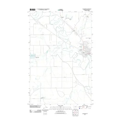
2011 Map of Glasgow
USGS Topo · Published 2011About this map
Glasgow serves as the focal point for this Valley County region, situated along the meandering course of the Milk River. In the early 21st century, the town shows a well-developed municipal footprint, including the Glasgow Post Office, Glasgow Vol Fire Dept, and the Valley County Fairgrounds. The local infrastructure is shaped significantly by water management, evidenced by numerous structures such as the Sweet Carolyn Dam, Mahan and Hoyt Reservoir Dam, and the Glasgow Sewage Lagoon Dam.
Find a feature on this map
38 named features on this map. Tap any name to fly to it.
Don’t see what you’re looking for? This feature index may not catch every label — zoom into the map to look around manually.
Map Details
Editions of this 2011 Glasgow Map
This is the sole edition of this map. No revisions or reprints were ever made.
Other maps of this area

1943 · Glasgow
USGS Topo · 1:125,000

1954 · Glasgow
USGS Topo · 1:250,000

1957 · Glasgow
USGS Topo · 1:250,000

1958 · Glasgow
USGS Topo · 1:250,000

1958 · Engstrom Ranch
USGS Topo · 1:24,000

1958 · Miller Coulee
USGS Topo · 1:62,500

1958 · Glasgow
USGS Topo · 1:24,000
1958 · Blanchard Ranch
USGS Topo · 1:24,000

1958 · Wheeler
USGS Topo · 1:24,000

1958 · Whately
USGS Topo · 1:24,000