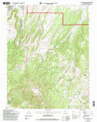
1994 Map of Glass Mountain
USGS Topo · Published 1997About this map
Glass Mountain dominates the southern landscape of this 1994 revision, rising above the complex drainage systems of the Inyo National Forest. The map documents a topography defined by steep canyons and seasonal water sources, including Dexter Spring and Canyon Spring in the northern reaches. High-altitude meadows such as Sawmill Meadow and Mc Gee Meadow indicate pockets of flatter terrain amidst the volcanic peaks and ridges. A sparse network of 4wd tracks provides the primary access through this remote portion of Mono County, connecting isolated landmarks like the Gravel Pit near the northern border to the southern heights of Black Mountain and Lake Mountain. This survey reflects the forest management priorities of the late twentieth century, focusing on hydrological features and established primitive routes through the Glass Mountain Ridge.
Find a feature on this map
29 named features on this map. Tap any name to fly to it.
Don’t see what you’re looking for? This feature index may not catch every label — zoom into the map to look around manually.
Map Details
Editions of this 1994 Glass Mountain Map
2 editions found
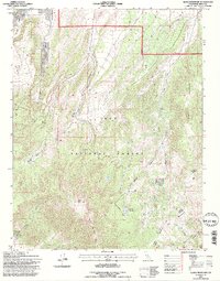
Other maps of this area

1914 · Mt. Morrison
USGS Topo · 1:125,000

1947 · Mariposa
USGS Topo · 1:250,000

1948 · Mariposa
USGS Topo · 1:250,000

1953 · Mt. Morrison
USGS Topo · 1:62,500

1953 · Casa Diablo Mtn
USGS Topo · 1:62,500

1957 · Mariposa
USGS Topo · 1:250,000

1962 · Cowtrack Mtn
USGS Topo · 1:62,500

1962 · Glass Mountain
USGS Topo · 1:62,500

1963 · Mariposa
USGS Topo · 1:250,000
1983 · Whitmore Hot Sprs
USGS Topo · 1:24,000