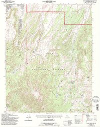
1994 Map of Glass Mountain
USGS Topo · Published 1997About this map
Glass Mountain and the high volcanic ridges of the Inyo National Forest dominate this 1990s topographic study. The landscape is defined by a complex network of seasonal drainages and springs that support high-altitude grazing and transit corridors. The transition from the steep eastern slopes of Black Mountain to the more open reaches of Sawmill Meadow and Ranger Meadows suggests a history of livestock management and seasonal ranger patrols. Numerous canyons, including Dexter Canyon, Taylor Canyon, and Mc Gee Canyon, carve through the terrain, while reliable water sources like Dexter Spring provide critical landmarks in an otherwise arid environment. The map details the primitive road network and 4WD trails that connect these remote basins, reflecting the area's ongoing use for forest management and back-country access at the end of the 20th century.
Find a feature on this map
21 named features on this map. Tap any name to fly to it.
Don’t see what you’re looking for? This feature index may not catch every label — zoom into the map to look around manually.
Map Details
Editions of this 1994 Glass Mountain Map
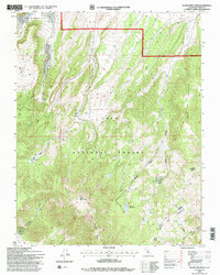
2 editions found
Other maps of this area

1914 · Mt. Morrison
USGS Topo · 1:125,000

1947 · Mariposa
USGS Topo · 1:250,000

1948 · Mariposa
USGS Topo · 1:250,000

1953 · Mt. Morrison
USGS Topo · 1:62,500

1953 · Casa Diablo Mtn
USGS Topo · 1:62,500

1957 · Mariposa
USGS Topo · 1:250,000

1962 · Cowtrack Mtn
USGS Topo · 1:62,500

1962 · Glass Mountain
USGS Topo · 1:62,500

1963 · Mariposa
USGS Topo · 1:250,000
1983 · Whitmore Hot Sprs
USGS Topo · 1:24,000