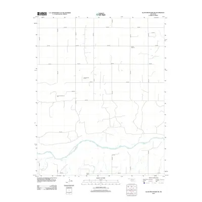
2012 Map of Glass Mountains NE
USGS Topo · Published 2012About this map
The Cimarron River winds through the southern reaches of this Alfalfa County landscape, shaping a terrain defined by broad plains and the notable rise of Lone Peak. In 2012, the region's economy is clearly anchored in energy extraction, with the extensive Oakdale Gas and Oil Field and the Southwest Oakdale Gas Field dominating the central and western sections of the map. These industrial footprints contrast with the established agricultural grid of local roads like e0360 RD and n2500 RD. For those tracing local heritage, the Pleasant Ridge Cem stands as a quiet landmark of the community's history, while the drainage of Cheyenne Cr and the presence of Gard Lake illustrate the local hydrology of the western Oklahoma plains.
Find a feature on this map
24 named features on this map. Tap any name to fly to it.
Don’t see what you’re looking for? This feature index may not catch every label — zoom into the map to look around manually.
Map Details
Editions of this 2012 Glass Mountains NE Map
This is the sole edition of this map. No revisions or reprints were ever made.
Other maps of this area

1955 · Woodward
USGS Topo · 1:250,000

1958 · Woodward
USGS Topo · 1:250,000

1968 · Carmen
USGS Topo · 1:24,000

1969 · Dacoma SW
USGS Topo · 1:24,000

1969 · Glass Mountains NW
USGS Topo · 1:24,000

1969 · Glass Mountains
USGS Topo · 1:24,000

1969 · Fairview
USGS Topo · 1:24,000

1969 · Cleo Springs
USGS Topo · 1:24,000

1969 · Glass Mountains NE
USGS Topo · 1:24,000

1969 · Glass Mountains SW
USGS Topo · 1:24,000