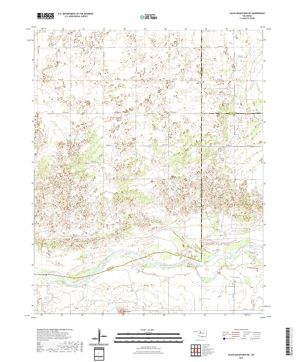
2022 Map of Glass Mountains NE
USGS Topo · Published 2022About this map
The Cimarron River carves a wide path through this portion of Oklahoma, defining the landscape where Woods, Alfalfa, and Major counties converge. The terrain is characterized by the distinct elevation of Lone Peak and the drainage systems of Cheyenne Cr, which feed into the river valley. For those researching family history in the region, Pleasant Ridge Cem stands as a primary landmark in the northern reaches of the quadrangle, situated near the intersection of e0370 RD and n2510 RD.
Find a feature on this map
35 named features on this map. Tap any name to fly to it.
Don’t see what you’re looking for? This feature index may not catch every label — zoom into the map to look around manually.
Map Details
Editions of this 2022 Glass Mountains NE Map
This is the sole edition of this map. No revisions or reprints were ever made.
Other maps of this area

1955 · Woodward
USGS Topo · 1:250,000

1958 · Woodward
USGS Topo · 1:250,000

1968 · Carmen
USGS Topo · 1:24,000

1969 · Dacoma SW
USGS Topo · 1:24,000

1969 · Glass Mountains NW
USGS Topo · 1:24,000

1969 · Glass Mountains
USGS Topo · 1:24,000

1969 · Fairview
USGS Topo · 1:24,000

1969 · Cleo Springs
USGS Topo · 1:24,000

1969 · Glass Mountains NE
USGS Topo · 1:24,000

1969 · Glass Mountains SW
USGS Topo · 1:24,000