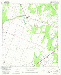
1953 Map of Glen Flora
USGS Topo · Published 1980About this map
Glen Flora and the surrounding Wharton County coastal plains are defined by the winding course of the Colorado River and a sophisticated network of water management. Compiled from 1951 aerial photography with 1970s revisions, the map reveals an agricultural landscape reliant on the Pierce Pumping Sta and the Pierce Canal, alongside various levee and ditch systems. This irrigation infrastructure supported the rural economy between the Atchison Topeka and Santa Fe and Southern Pacific rail lines.
Find a feature on this map
29 named features on this map. Tap any name to fly to it.
Don’t see what you’re looking for? This feature index may not catch every label — zoom into the map to look around manually.
Map Details
Editions of this 1953 Glen Flora Map
Other maps of this area

1952 · Lane City
USGS Topo · 1:24,000

1952 · Pierce
USGS Topo · 1:24,000

1952 · Egypt
USGS Topo · 1:24,000

1953 · Wharton
USGS Topo · 1:24,000

1953 · Hungerford
USGS Topo · 1:24,000

1953 · Glen Flora
USGS Topo · 1:24,000

1953 · Seguin
USGS Topo · 1:250,000

1958 · Seguin
USGS Topo · 1:250,000

1959 · Bonus
USGS Topo · 1:24,000

1960 · New Taiton
USGS Topo · 1:24,000