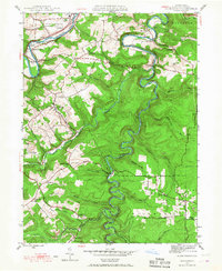
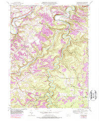
1944 Map of Glen Richey
USGS Topo · Published 1967About this map
Clearfield Creek carves a deeply winding path through this central Pennsylvania landscape, serving as a primary geographic anchor for small settlements and rural homesteads during the mid-1940s. The settlement of Glen Richey and nearby Oshanter occupy the high ground between the creek and its tributaries, while further south, the B & O Railroad connects the community of Boardman to the wider region. The map reveals a high density of rural social infrastructure, from the Mt Zion Ch to several hilltop schools like Pleasant Ridge Sch and Turkey Hill Sch.
Find a feature on this map
49 named features on this map. Tap any name to fly to it.
Don’t see what you’re looking for? This feature index may not catch every label — zoom into the map to look around manually.
Map Details
Editions of this 1944 Glen Richey Map
5 editions found
Other maps of this area

1903 · Curwensville
USGS Topo · 1:62,500

1903 · Houtzdale
USGS Topo · 1:62,500

1905 · Houtzdale
USGS Topo · 1:62,500

1929 · Clearfield
USGS Topo · 1:48,000

1929 · Penfield
USGS Topo · 1:62,500

1932 · Clearfield
USGS Topo · 1:62,500

1932 · Penfield
USGS Topo · 1:62,500

1939 · Curwensville
USGS Topo · 1:62,500

1942 · Curwensville
USGS Topo · 1:62,500

1943 · Punxsutawney
USGS Topo · 1:125,000