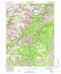
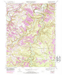
1944 Map of Glen Richey
USGS Topo · Published 1982About this map
Clearfield Creek winds in dramatic loops through the center of this landscape, its deep valley separating the townships of Lawrence, Bradford, and Woodward. The industrial and transportation history of the region is evident in the transition from the Old RR Grade to active Conrail lines, which follow the steep contours of the creek and the West Branch Susquehanna River. Small rural settlements like Glen Richey, Faunce, and Boardman are scattered across the higher ground, supported by a network of local institutions including Pleasant Ridge School and Mt Zion Church. A notable fire tower stands near Oshanter, overlooking the heavily wooded ridges and the numerous runs, such as Morgan Run and Sanbourn Run, that feed into the primary waterways. The map also captures specialized land uses, from the Clearfield and Curwensville Country Club in the north to the Thompson Cem and Stoneville Cem, which offer significant value for genealogical research.
Find a feature on this map
48 named features on this map. Tap any name to fly to it.
Don’t see what you’re looking for? This feature index may not catch every label — zoom into the map to look around manually.
Map Details
Editions of this 1944 Glen Richey Map
5 editions found
Other maps of this area

1903 · Curwensville
USGS Topo · 1:62,500

1903 · Houtzdale
USGS Topo · 1:62,500

1905 · Houtzdale
USGS Topo · 1:62,500

1929 · Clearfield
USGS Topo · 1:48,000

1929 · Penfield
USGS Topo · 1:62,500

1932 · Clearfield
USGS Topo · 1:62,500

1932 · Penfield
USGS Topo · 1:62,500

1939 · Curwensville
USGS Topo · 1:62,500

1942 · Curwensville
USGS Topo · 1:62,500

1943 · Punxsutawney
USGS Topo · 1:125,000