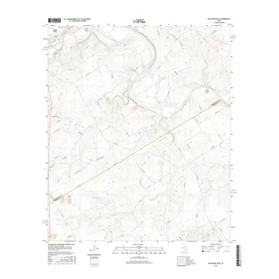
2016 Map of Glen Rose East
USGS Topo · Published 2016About this map
Glen Rose serves as the focal point of this survey, positioned where the Paluxy River joins the larger Brazos River. This region of Texas is defined by the winding paths of these waterways, which have carved through the landscape to create distinct drainage patterns involving Montgomery Br, Buck Cr, and Rock Cr. The map captures a transitional rural landscape where traditional ranching and aviation intersect, evidenced by the Wyatt 3-Rivers Airport near the river junction and the Little 'L' Ranch Airport further east.
Find a feature on this map
66 named features on this map. Tap any name to fly to it.
Don’t see what you’re looking for? This feature index may not catch every label — zoom into the map to look around manually.
Map Details
Editions of this 2016 Glen Rose East Map
This is the sole edition of this map. No revisions or reprints were ever made.
Other maps of this area

1889 · Granbury
USGS Topo · 1:125,000

1924 · Granbury 1-c
USGS Topo · 1:48,000

1924 · Granbury 4-a
USGS Topo · 1:48,000

1928 · Godley
USGS Topo · 1:62,500

1931 · Morgan
USGS Topo · 1:62,500

1931 · Tolar
USGS Topo · 1:62,500

1954 · Dallas
USGS Topo · 1:250,000

1958 · Dallas
USGS Topo · 1:250,000
1961 · Hill City
USGS Topo · 1:24,000
1961 · Nemo
USGS Topo · 1:24,000