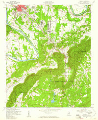
1956 Map of Glencoe
USGS Topo · Published 1961About this map
The Gadsden Air Force Depot and its associated rail infrastructure define the landscape south of Gadsden in the mid-1950s. The Louisville and Nashville RR cuts a straight path through Glencoe, connecting the industrial fringes of East Gadsden with the rural settlements to the south. The terrain is dramatically marked by the ridge of Colvin Mountain, which creates a natural barrier between Etowah and Calhoun counties, pierced only by local crossings like Walker Gap and Alexander Gap.
Find a feature on this map
41 named features on this map. Tap any name to fly to it.
Don’t see what you’re looking for? This feature index may not catch every label — zoom into the map to look around manually.
Map Details
Editions of this 1956 Glencoe Map
3 editions found
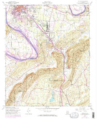
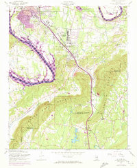
Other maps of this area

1885 · Gadsden
USGS Topo · 1:125,000

1888 · Gadsden
USGS Topo · 1:125,000

1889 · Springville
USGS Topo · 1:125,000

1892 · Springville
USGS Topo · 1:125,000

1892 · Gadsden
USGS Topo · 1:125,000

1893 · Fort Payne
USGS Topo · 1:125,000

1895 · Gadsden
USGS Topo · 1:125,000

1898 · Fort Payne
USGS Topo · 1:125,000

1900 · Fort Payne
USGS Topo · 1:125,000

1900 · Anniston
USGS Topo · 1:125,000