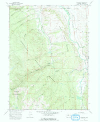
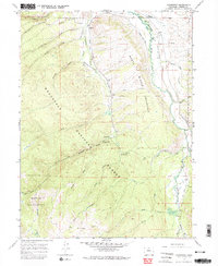
1967 Map of Glendevey
USGS Topo · Published 1974About this map
The settlement of Glendevey and the Glendevey PO anchor this high-altitude landscape in the 1960s, situated where the Laramie River flows through the northern reaches of the Roosevelt National Forest. The map captures a complex system of water management essential for mountain agriculture, featuring numerous named irrigation works like the Stuart Ditch No 1, Homestead McIntyre Ditch, and Martin Ditch No 1 that lace the valley floor. To the west, the terrain rises sharply into the Rawah Wilderness, defined by drainage basins for McIntyre Creek and Stuart Creek. Historic recreational use is evident at Hooligan Roost Campground and Browns Park Campground, while the small Cem near the river and the remote junction at Four Corners provide specific points of interest for genealogists tracing early Larimer County residents and ranchers.
Find a feature on this map
64 named features on this map. Tap any name to fly to it.
Don’t see what you’re looking for? This feature index may not catch every label — zoom into the map to look around manually.
Map Details
Editions of this 1967 Glendevey Map
5 editions found
Other maps of this area

1916 · Home
USGS Topo · 1:125,000

1920 · Home
USGS Topo · 1:125,000

1954 · Greeley
USGS Topo · 1:250,000

1954 · Craig
USGS Topo · 1:250,000

1955 · Old Roach
USGS Topo · 1:24,000

1955 · Shipman Mountain
USGS Topo · 1:24,000

1955 · Kings Canyon
USGS Topo · 1:62,500

1956 · Johnny Moore Mountain
USGS Topo · 1:24,000
1956 · Gould
USGS Topo · 1:62,500

1957 · Craig
USGS Topo · 1:250,000