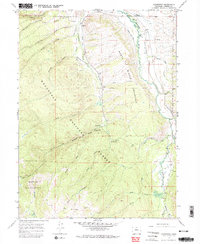
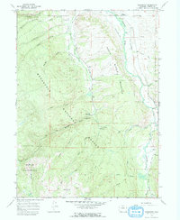
1967 Map of Glendevey
USGS Topo · Published 1974About this map
Glendevey and the Glendevey Po sit at a high-elevation nexus where the North Middle Laramie River meets a network of mountain creeks and irrigation systems. This late 1960s survey documents a landscape defined by water management and recreational use within the Roosevelt National Forest. Significant irrigation infrastructure, such as the Stuart Ditch and the Homestead Mc Intyre Ditch, illustrates the complex effort to divert alpine runoff for agricultural use downstream.
Find a feature on this map
46 named features on this map. Tap any name to fly to it.
Don’t see what you’re looking for? This feature index may not catch every label — zoom into the map to look around manually.
Map Details
Editions of this 1967 Glendevey Map
5 editions found
Other maps of this area

1916 · Home
USGS Topo · 1:125,000

1920 · Home
USGS Topo · 1:125,000

1954 · Greeley
USGS Topo · 1:250,000

1954 · Craig
USGS Topo · 1:250,000

1955 · Old Roach
USGS Topo · 1:24,000

1955 · Shipman Mountain
USGS Topo · 1:24,000

1955 · Kings Canyon
USGS Topo · 1:62,500

1956 · Johnny Moore Mountain
USGS Topo · 1:24,000
1956 · Gould
USGS Topo · 1:62,500

1957 · Craig
USGS Topo · 1:250,000