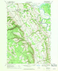
1966 Map of Glenfield
USGS Topo · Published 1970About this map
Martinsburg and the surrounding Lewis County landscape are defined by the dramatic descent from the Tug Hill plateau toward the Black River valley. This mid-century survey captures a rural economy shifting between traditional agriculture and emerging recreation, noted by the presence of a Ski Lift near Turin and a Drive-in Theater along the highway. Large tracts of the Tug Hill State Forest Preserve and Whetstone Gulf State Park protect the steep ravines of Whetstone Creek, while the valley floor supports transport along the Penn Central Railroad. Genealogists will find several burial sites including Old Martinsburg Cem and Burdicks Crossing Cem, along with the St Hedwigs Ch in Houseville. Local education is anchored by the Gen Martin High Sch and South Lewis High Sch, serving dispersed hamlets like Glendale and Atwater.
Find a feature on this map
77 named features on this map. Tap any name to fly to it.
Don’t see what you’re looking for? This feature index may not catch every label — zoom into the map to look around manually.
Map Details
Editions of this 1966 Glenfield Map
3 editions found
Other maps of this area

1902 · Carthage
USGS Topo · 1:62,500

1904 · Carthage
USGS Topo · 1:62,500

1905 · Port Leyden
USGS Topo · 1:62,500

1906 · Highmarket
USGS Topo · 1:62,500

1907 · Port Leyden
USGS Topo · 1:62,500

1911 · Lowville
USGS Topo · 1:62,500

1913 · Lowville
USGS Topo · 1:62,500

1940 · Port Leyden
USGS Topo · 1:62,500

1943 · West Lowville
USGS Topo · 1:31,680

1943 · High Market
USGS Topo · 1:24,000