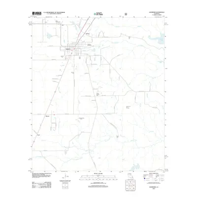
2012 Map of Glenmora
USGS Topo · Published 2012About this map
Glenmora serves as the primary hub of this Central Louisiana landscape, where the town's street grid, including 14th Ave and Iles St, meets the timber and agriculture lands of Rapides Parish. The settlement pattern is defined by its proximity to the winding waters of Bayou Cocodrie and the sprawling Cocodrie Lake to the east. The map reveals a high density of private aviation and industrial markers, from the Glenmora Oil and Gas Field to numerous local runways like James Landing Strip and the Jasmine Hill Airport. Genealogists will find several burial sites well-marked across the terrain, such as Science Hill Cem and Rocky Hill Cem. Smaller settlements such as McNary, Pearl, and Blanche anchor the rural corners of the quadrangle, connected by a network of drainage ways including Little Spring Cr and Clear Cr.
Find a feature on this map
82 named features on this map. Tap any name to fly to it.
Don’t see what you’re looking for? This feature index may not catch every label — zoom into the map to look around manually.
Map Details
Editions of this 2012 Glenmora Map
This is the sole edition of this map. No revisions or reprints were ever made.
Other maps of this area

1935 · Beaver
USGS Topo · 1:31,680

1935 · Pawnee
USGS Topo · 1:31,680

1935 · Oakdale
USGS Topo · 1:31,680

1935 · Turkey Creek
USGS Topo · 1:62,500

1935 · Lecompte
USGS Topo · 1:62,500

1942 · Oakdale
USGS Topo · 1:62,500

1949 · Glenmora
USGS Topo · 1:31,680

1949 · Turkey Creek
USGS Topo · 1:62,500

1952 · Lake Charles
USGS Topo · 1:250,000

1953 · Alexandria
USGS Topo · 1:250,000