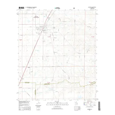
2015 Map of Glenmora
USGS Topo · Published 2015About this map
Glenmora serves as the central hub of this Rapides Parish landscape, situated at the edge of the Kisatchie National Forest. The town's grid is dense with named streets, including Martin L King Ave and a series of numbered avenues, reflecting its role as a local center for commerce and community. Just to the north lies McNary, while the smaller settlements of Blanche and Pearl mark the rural outskirts. Local heritage is preserved in numerous burial grounds, such as Rose Lawn Cem, Johnson Cem, and Science Hill Cem.
Find a feature on this map
58 named features on this map. Tap any name to fly to it.
Don’t see what you’re looking for? This feature index may not catch every label — zoom into the map to look around manually.
Map Details
Editions of this 2015 Glenmora Map
This is the sole edition of this map. No revisions or reprints were ever made.
Other maps of this area

1935 · Beaver
USGS Topo · 1:31,680

1935 · Pawnee
USGS Topo · 1:31,680

1935 · Oakdale
USGS Topo · 1:31,680

1935 · Turkey Creek
USGS Topo · 1:62,500

1935 · Lecompte
USGS Topo · 1:62,500

1942 · Oakdale
USGS Topo · 1:62,500

1949 · Glenmora
USGS Topo · 1:31,680

1949 · Turkey Creek
USGS Topo · 1:62,500

1952 · Lake Charles
USGS Topo · 1:250,000

1953 · Alexandria
USGS Topo · 1:250,000