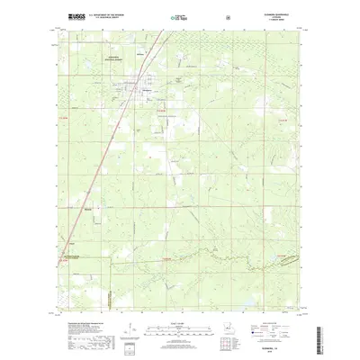
2018 Map of Glenmora
USGS Topo · Published 2018About this map
Glenmora and McNary serve as the primary population centers on this modern survey of the Louisiana piney woods, situated where the northern boundary of Kisatchie National Forest meets the developed corridors of Rapides Parish. The landscape is defined by its extensive drainage network, with Bayou Cocodrie winding through the southern reaches and Spring Creek and Clear Creek cutting through the timberlands. Numerous family and community landmarks are documented throughout the township, including several burial sites like Glenmora Cemetery and Rose Lawn Cemetery. Local infrastructure is represented by the Jasmine Hill Airport northeast of town and a grid of rural routes such as Dillon Loop and Hester Landing Road that provide access to the surrounding forest. The map also captures several smaller water bodies including Lake Hop-O-Bee and Lake Jubeniewa near the parish line.
Find a feature on this map
77 named features on this map. Tap any name to fly to it.
Don’t see what you’re looking for? This feature index may not catch every label — zoom into the map to look around manually.
Map Details
Editions of this 2018 Glenmora Map
This is the sole edition of this map. No revisions or reprints were ever made.
Other maps of this area

1935 · Beaver
USGS Topo · 1:31,680

1935 · Pawnee
USGS Topo · 1:31,680

1935 · Oakdale
USGS Topo · 1:31,680

1935 · Turkey Creek
USGS Topo · 1:62,500

1935 · Lecompte
USGS Topo · 1:62,500

1942 · Oakdale
USGS Topo · 1:62,500

1949 · Glenmora
USGS Topo · 1:31,680

1949 · Turkey Creek
USGS Topo · 1:62,500

1952 · Lake Charles
USGS Topo · 1:250,000

1953 · Alexandria
USGS Topo · 1:250,000