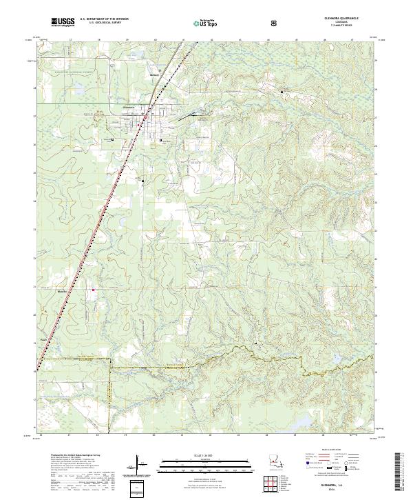
2024 Map of Glenmora
USGS Topo · Published 2024About this map
Glenmora serves as the central hub of this region where the southern reaches of Kisatchie National Forest meet the winding waters of Bayou Cocodrie. The settlement pattern follows the grid of Glenmora and the smaller community of McNary to the north, while the surrounding landscape is defined by its numerous small burial grounds, including Rocky Hill Cem and Science Hill Cem, which offer significant value for genealogical research. The local geography is further shaped by timber and aviation, evidenced by the Jasmine Hill Airport and numerous forest access roads. To the north, distinct water features like Lake Hop-O-Bee and Lake Jabenicwa sit near the parish line, illustrating the complex drainage of the Spring Creek and Little Spring Creek systems that feed into the larger bayous.
Find a feature on this map
78 named features on this map. Tap any name to fly to it.
Don’t see what you’re looking for? This feature index may not catch every label — zoom into the map to look around manually.
Map Details
Editions of this 2024 Glenmora Map
This is the sole edition of this map. No revisions or reprints were ever made.
Other maps of this area

1935 · Beaver
USGS Topo · 1:31,680

1935 · Pawnee
USGS Topo · 1:31,680

1935 · Oakdale
USGS Topo · 1:31,680

1935 · Turkey Creek
USGS Topo · 1:62,500

1935 · Lecompte
USGS Topo · 1:62,500

1942 · Oakdale
USGS Topo · 1:62,500

1949 · Glenmora
USGS Topo · 1:31,680

1949 · Turkey Creek
USGS Topo · 1:62,500

1952 · Lake Charles
USGS Topo · 1:250,000

1953 · Alexandria
USGS Topo · 1:250,000