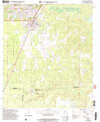
2003 Map of Glenmora
USGS Topo · Published 2005About this map
Glenmora and McNary anchor the northern landscape of this central Louisiana survey, marking a dense intersection of municipal boundaries and transportation corridors. The region is characterized by its complex hydrology, where Cocodrie Bayou and its numerous tributaries like Langs Bayou and McKemey Branch wind through a topography dotted with small-scale aviation sites including Miller Landing Strip and Angrus Landing Field. For genealogists and local historians, the map provides precise locations for several family and community landmarks, such as Rose Lawn Cem, Johnson Cem, and Rocky Hill Cem. The southern reach of the Kisatchie National Forest dominates the western edge, illustrating the enduring relationship between the timberlands and the surrounding parishes. This 2003 revision reflects a landscape where rural industry and aviation co-exist alongside older settlements like Blanche.
Find a feature on this map
34 named features on this map. Tap any name to fly to it.
Don’t see what you’re looking for? This feature index may not catch every label — zoom into the map to look around manually.
Map Details
Editions of this 2003 Glenmora Map
This is the sole edition of this map. No revisions or reprints were ever made.
Other maps of this area

1935 · Beaver
USGS Topo · 1:31,680

1935 · Pawnee
USGS Topo · 1:31,680

1935 · Oakdale
USGS Topo · 1:31,680

1935 · Turkey Creek
USGS Topo · 1:62,500

1935 · Lecompte
USGS Topo · 1:62,500

1942 · Oakdale
USGS Topo · 1:62,500

1949 · Glenmora
USGS Topo · 1:31,680

1949 · Turkey Creek
USGS Topo · 1:62,500

1952 · Lake Charles
USGS Topo · 1:250,000

1953 · Alexandria
USGS Topo · 1:250,000